Welcome to WordPress. This is your first post. Edit or delete it, then start writing!
Blog
-
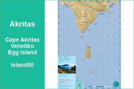
Akritas Map
[su_carousel source=”media: 3600,2634,3650″ limit=”3″ width=”950″ height=”200″ title=”no” arrows=”no” pages=”no” mousewheel=”no” autoplay=”9000″ speed=”18000″]
Akritas (Island50) Map
[slide-anything id=”2771″]
Detailed, A Must Have
Discover Cape Akritas, Venetiko & Egg Island.
[su_column size=”4/5″ center=”yes”]
[su_list icon=”icon: info-circle” icon_color=”#1ABC9C”]
- [su_permalink id=”3599″ target=”blank”][/su_permalink]
- The map is available digital for mobile devices for offline use.
- Get Cape Akritas – Venetiko – Egg Island (Island50) on Avenza Maps!
[su_qrcode data=”https://store.avenza.com/products/cape-akritas-venetiko-egg-island-island50-stefanos-maps-map?utm_source=vendor_link” title=”Akritas (Island50) Map” size=”130″ margin=”10″ link=”https://store.avenza.com/products/cape-akritas-venetiko-egg-island-island50-stefanos-maps-map?utm_source=vendor_link” color=”#1ABC9C”]
[/su_list]
[/su_column]
[su_divider top=”no” style=”dotted” divider_color=”#1ABC9C” link_color=”#ffffff” size=”2″ margin=”5″]Why Akritas Map

Cape Akritas is the Southiest Mainland Point of Messinia. The topographic and mounaneous area of Cape Akritas is called Selitsa with only few inhabitants, but more and more new holiday houses.
In the South of the Cape, you find Islands:
[su_column size=”4/5″ center=”yes”]
[su_list icon=”icon: location-arrow” icon_color=”#1ABC9C”]- Venetiko, inhabitated, a 181 m high mountain, about 1.6 km away from Cape Akritas
- Egg Island, a group of 3 small rocky Islets, another 2 km from Venetiko in the South
[/su_list]
[su_list icon=”icon: map” icon_color=”#1ABC9C”]
- Extent:
North: Tsapi – Koukouras
South: Egg Island - incl. Bathymetry Contourlines 20m
- The map is independent and more detailed of other printed or online maps from Google, Bing, Apple or Here … .
[/su_list]
[/su_column]
[su_divider top=”no” style=”dotted” divider_color=”#1ABC9C” link_color=”#ffffff” size=”2″ margin=”5″]Discover the beauty of Akritas Area and its Islands with the Akritas Map.
[AdSense-A]
[mp_easy_icon icon=”fa-cart-arrow-down” color=”#1abc9c” left_space=”5″ right_space=”5″ vertical_offset=”0″]get the map here:[mp_easy_icon icon=”fa-cart-arrow-down” color=”#1abc9c” left_space=”5″ right_space=”5″ vertical_offset=”0″]
[wppa type=”photo” photo=”481″ size=”128″ align=”center”]get map
[su_divider top=”no” style=”dotted” divider_color=”#1ABC9C” link_color=”#ffffff” size=”2″ margin=”5″]Related to Akritas
[pt_view id=”13d3c61m2x”]
General Infos about Koroni Map Series
The Vasilitsi City Map is part of the Koroni Map Series.
General Information about the Map and the digital app needed for the digital map:
[su_column size=”4/5″ center=”yes”][su_list icon=”icon: map-o” icon_color=”#1ABC9C”]
- [su_permalink id=”2427″ target=”blank”][/su_permalink]
[/su_list]
[/su_column]
Get the digital Akritas Map
[su_column size=”4/5″ center=”yes”]
[table id=16 /]
[/su_column]
Koroni Maps Overview
[slide-anything id=”2771″]
[table id=3 /]
[su_spoiler title=”Map News & History”]
[table id=8 /][/su_spoiler]
Koroni Maps
[pt_view id=”67febeeyh0″]
Koroni Photo Maps
[pt_view id=”764a39di5b”]
last update: 12. August 2025
published: 12. August 2025 -

Dimos Pylos-Nestoros (Kallikratis) Map

Koroni Map Series
[slide-anything id=”2771″]
Koroni is a small Town with Venecian Castle and Harbour in the South of Messinia, South West of Peloponnese, Greece.
Koroni has a large outback. It is also a nice holiday destination.For Koroni, there is “Koroni Map Series” with
[su_column size=”4/5″ center=”yes”]
[su_list icon=”icon: map” icon_color=”#1ABC9C”]- Topographic Surrounding Map
- Koroni City Map
- Koroni Kastro Maps
- Various Village & Hamlet Maps
- Overview Maps
[/su_list]
[/su_column]The Maps are designed for Koronians, Tourists, Holiday Guests, Mountain Bikers, Hikers, Map Lovers.
[su_column size=”4/5″ center=”yes”]
[su_list icon=”icon: info-circle” icon_color=”#1ABC9C”]- Some of the maps are available printed
- Most of the maps are available digital for mobile devices for offline use.
[/su_list]
[su_list icon=”icon: map” icon_color=”#1ABC9C”]- [su_permalink id=”2427″ target=”blank”][/su_permalink]
[/su_list]
[/su_column]
[mp_easy_icon icon=”fa-map” color=”#1abc9c” left_space=”10″ right_space=”10″ vertical_offset=”0″]Dimos Pylos-Nestoros (Kallikratis) Map[mp_easy_icon icon=”fa-map” color=”#1abc9c” left_space=”10″ right_space=”10″ vertical_offset=”0″]
In Greece two big Administration Reforms took place.
During 1997-2010 Koroni was an administrational unit Dimos (Municipality).
[su_divider top=”no” style=”dotted” divider_color=”#1ABC9C” link_color=”#ffffff” size=”2″ margin=”15″]Kapodistrias Reform 1997
Koroni Municipality was built from the ten former communities Akritochori, Charakopio, Chrysokellaria, Falanthi, Kaplani, Kompoi, Koroni, Vasilitsi,Vounaria, Yamia.
[su_column size=”4/5″ center=”yes”]
[su_list icon=”icon: map” icon_color=”#1ABC9C”]- [su_permalink id=”4065″ target=”blank”][/su_permalink]
[/su_list]
[/su_column][su_divider top=”no” style=”dotted” divider_color=”#1ABC9C” link_color=”#ffffff” size=”2″ margin=”15″]
Kallikratis Programm 2010
By the Kallikratis Programm 2010, Koroni got integrated in Dimos Pylos-Nestoros.
[su_divider top=”no” style=”dotted” divider_color=”#1ABC9C” link_color=”#ffffff” size=”2″ margin=”15″]
Dimos Pylos-Nestoros Kallikratis 2010 Map
Dimos Pylos-Nestoros Kallikratis 2010 Map givs you an overview of the areas of the former communities of the actual administration units.
The map covers Dimos-Pylos Nestoros.
[AdSense-A]
[mp_easy_icon icon=”fa-cart-arrow-down” color=”#1abc9c” left_space=”5″ right_space=”5″ vertical_offset=”0″]get the map here:[mp_easy_icon icon=”fa-cart-arrow-down” color=”#1abc9c” left_space=”5″ right_space=”5″ vertical_offset=”0″]
[wppa type=”photo” photo=”476″ size=”128″ align=”center”]get map
Get the digital Koroni Maps
[su_column size=”4/5″ center=”yes”]
[table id=16 /]
[/su_column]
Koroni Surroundings City Villages Kastro Maps Overview
[slide-anything id=”2771″]
[table id=3 /]
[su_spoiler title=”Map News & History”]
[table id=8 /][/su_spoiler]
Koroni Maps
[pt_view id=”67febeeyh0″]
Koroni Photo Maps
[pt_view id=”764a39di5b”]
last update: 28. July 2025
published: 28. July 2025 -

Koroni Dimos (Kapodistrias) Map

Koroni Map Series
[slide-anything id=”2771″]
Koroni is a small Town with Venecian Castle and Harbour in the South of Messinia, South West of Peloponnese, Greece.
Koroni has a large outback. It is also a nice holiday destination.For Koroni, there is “Koroni Map Series” with
[su_column size=”4/5″ center=”yes”]
[su_list icon=”icon: map” icon_color=”#1ABC9C”]- Topographic Surrounding Map
- Koroni City Map
- Koroni Kastro Maps
- Various Village & Hamlet Maps
- Overview Maps
[/su_list]
[/su_column]The Maps are designed for Koronians, Tourists, Holiday Guests, Mountain Bikers, Hikers, Map Lovers.
[su_column size=”4/5″ center=”yes”]
[su_list icon=”icon: info-circle” icon_color=”#1ABC9C”]- Some of the maps are available printed
- Most of the maps are available digital for mobile devices for offline use.
[/su_list]
[su_list icon=”icon: map-o” icon_color=”#1ABC9C”]- [su_permalink id=”2427″ target=”blank”][/su_permalink]
[/su_list]
[/su_column]
[mp_easy_icon icon=”fa-map” color=”#1abc9c” left_space=”10″ right_space=”10″ vertical_offset=”0″]Koroni Dimos Map[mp_easy_icon icon=”fa-map” color=”#1abc9c” left_space=”10″ right_space=”10″ vertical_offset=”0″]
In Greece two big Administration Reforms took place.
During 1997-2010 Koroni was an administrational unit Dimos (Municipality).
[su_divider top=”no” style=”dotted” divider_color=”#1ABC9C” link_color=”#ffffff” size=”2″ margin=”15″]Kapodistrias Reform 1997
Koroni Municipality was built from the ten former communities
[su_column size=”4/5″ center=”yes”]
[su_list icon=”icon: check-square-o” icon_color=”#1ABC9C”]- Akritochori – [mp_easy_icon icon=”fa-map” color=”#1abc9c” left_space=”5″ right_space=”5″ vertical_offset=”0″][su_permalink id=”3898″ target=”blank”][/su_permalink][mp_easy_icon icon=”fa-map” color=”#1abc9c” left_space=”5″ right_space=”5″ vertical_offset=”0″]
- Charakopio – [mp_easy_icon icon=”fa-map” color=”#1abc9c” left_space=”5″ right_space=”5″ vertical_offset=”0″][su_permalink id=”3492″ target=”blank”][/su_permalink][mp_easy_icon icon=”fa-map” color=”#1abc9c” left_space=”5″ right_space=”5″ vertical_offset=”0″]
- Chrysokellaria – [mp_easy_icon icon=”fa-map” color=”#1abc9c” left_space=”5″ right_space=”5″ vertical_offset=”0″][su_permalink id=”3490″ target=”blank”][/su_permalink][mp_easy_icon icon=”fa-map” color=”#1abc9c” left_space=”5″ right_space=”5″ vertical_offset=”0″]
- Falanthi
- Kaplani
- Kompoi
- Koroni – [mp_easy_icon icon=”fa-map” color=”#1abc9c” left_space=”5″ right_space=”5″ vertical_offset=”0″][su_permalink id=”1192″ target=”blank” title=”Koroni City Maps”][/su_permalink][mp_easy_icon icon=”fa-map” color=”#1abc9c” left_space=”5″ right_space=”5″ vertical_offset=”0″]
- Vasilitsi – [mp_easy_icon icon=”fa-map” color=”#1abc9c” left_space=”5″ right_space=”5″ vertical_offset=”0″][su_permalink id=”3415″ target=”blank”][/su_permalink][mp_easy_icon icon=”fa-map” color=”#1abc9c” left_space=”5″ right_space=”5″ vertical_offset=”0″]
- Vounaria – [mp_easy_icon icon=”fa-map” color=”#1abc9c” left_space=”5″ right_space=”5″ vertical_offset=”0″][su_permalink id=”3455″ target=”blank”][/su_permalink][mp_easy_icon icon=”fa-map” color=”#1abc9c” left_space=”5″ right_space=”5″ vertical_offset=”0″]
- Yamia
[/su_list]
[/su_column][su_divider top=”no” style=”dotted” divider_color=”#1ABC9C” link_color=”#ffffff” size=”2″ margin=”15″]
Kallikratis Programm 2010
By the Kallikratis Programm 2010, Koroni got integrated in Dimos Pylos-Nestoros.
[su_column size=”4/5″ center=”yes”]
[su_list icon=”icon: map” icon_color=”#1ABC9C”]- [su_permalink id=”4126″ target=”blank”][/su_permalink]
[/su_list]
[/su_column][su_divider top=”no” style=”dotted” divider_color=”#1ABC9C” link_color=”#ffffff” size=”2″ margin=”15″]
Koroni Dimos Kapodistrias (1997-2010) Map
Koroni Dimos Kapodistrias (1997-2010) Map gives you an overview of the areas of the former communities an the actual administration units.
The map has the same extent as [mp_easy_icon icon=”fa-map” color=”#1abc9c” left_space=”5″ right_space=”5″ vertical_offset=”0″][su_permalink id=”1448″ target=”blank”][/su_permalink][mp_easy_icon icon=”fa-map” color=”#1abc9c” left_space=”5″ right_space=”5″ vertical_offset=”0″].
[AdSense-A]
[mp_easy_icon icon=”fa-cart-arrow-down” color=”#1abc9c” left_space=”5″ right_space=”5″ vertical_offset=”0″]get the map here:[mp_easy_icon icon=”fa-cart-arrow-down” color=”#1abc9c” left_space=”5″ right_space=”5″ vertical_offset=”0″]
[wppa type=”photo” photo=”475″ size=”128″ align=”center”]get map
Get the digital Koroni Maps
[su_column size=”4/5″ center=”yes”]
[table id=16 /]
[/su_column]
Koroni Surroundings City Villages Kastro Maps Overview
[slide-anything id=”2771″]
[table id=3 /]
[su_spoiler title=”Map News & History”]
[table id=8 /][/su_spoiler]
Koroni Maps
[pt_view id=”67febeeyh0″]
Koroni Photo Maps
[pt_view id=”764a39di5b”]
last update: 05. September 2025
published: 28. July 2025 -
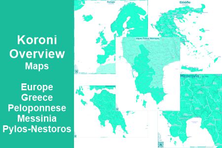
Koroni Overview Maps
[su_carousel source=”media: 4165,4036,4037,4038,4053″ limit=”4″ width=”950″ height=”200″ title=”no” arrows=”no” pages=”no” mousewheel=”no” autoplay=”9000″ speed=”18000″]
Koroni Map Series
[slide-anything id=”2771″]
Koroni is a small Town with Venecian Castle and Harbour in the South of Messinia, South West of Peloponnese, Greece.
Koroni has a large outback. It is also a nice holiday destination.For Koroni, there is “Koroni Map Series” with
[su_column size=”4/5″ center=”yes”]
[su_list icon=”icon: map” icon_color=”#1ABC9C”]- Topographic Surrounding Map
- Koroni City Map
- Koroni Kastro Maps
- Various Village & Hamlet Maps
- Overview Maps
[/su_list]
[/su_column]The Maps are designed for Koronians, Tourists, Holiday Guests, Mountain Bikers, Hikers, Map Lovers.
[su_column size=”4/5″ center=”yes”]
[su_list icon=”icon: info-circle” icon_color=”#1ABC9C”]- Some of the maps are available printed
- Most of the maps are available digital for mobile devices for offline use.
[/su_list]
[su_list icon=”icon: map-o” icon_color=”#1ABC9C”]- [su_permalink id=”2427″ target=”blank”][/su_permalink]
[/su_list]
[/su_column]
[su_divider top=”no” style=”dotted” divider_color=”#1ABC9C” link_color=”#ffffff” size=”2″ margin=”5″]Overview Maps
the overview maps ara adittional maps to the Koroni Surroundings City Villages und Kastro map. They compain you an your European Way from and to Koroni.
In the ditigal app for tha maps, you can track your way. With these maps you get the overview to the surroundings of your track.[su_table responsive=”yes” alternate=”no” fixed=”yes”]
Map Preview QR Avenza App Map Scale Language Pylos-Nestoros 
[wppa type=”photo” photo=”477″ size=”100″ align=”center”]get map 1:150’000 en,el Messinia 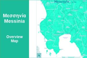
[wppa type=”photo” photo=”468″ size=”100″ align=”center”]get map 1:250’000 en,el [wppa type=”photo” photo=”469″ size=”100″ align=”center”]get map 1:500’000 en,el Peloponnese 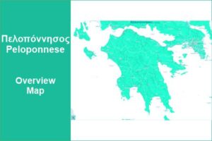
[wppa type=”photo” photo=”471″ size=”100″ align=”center”]met map 1:750’000 en,el [wppa type=”photo” photo=”470″ size=”100″ align=”center”]get map 1:1Mio. en,el Greece 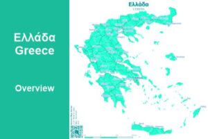
[wppa type=”photo” photo=”467″ size=”100″ align=”center”]get map 1:2.5Mio en,el [wppa type=”photo” photo=”466″ size=”100″ align=”center”]get map 1:5Mio en,el Europe 
[wppa type=”photo” photo=”464″ size=”100″ align=”center”]get map 1:20Mio. International [/su_table]
[AdSense-A]
Get the digital Koroni Maps
[su_column size=”4/5″ center=”yes”]
[table id=16 /]
[/su_column]
Koroni Surroundings City Villages Kastro Maps Overview
[slide-anything id=”2771″]
[table id=3 /]
[su_spoiler title=”Map News & History”]
[table id=8 /][/su_spoiler]
Koroni Maps
[pt_view id=”67febeeyh0″]
Koroni Photo Maps
[pt_view id=”764a39di5b”]
last update: 25. July 2025
published: 25. July 2025 -

Akritochori City Map
[wppa type=”photo” photo=”452″ size=”250″ align=”center”]Akritochori City Map
[slide-anything id=”2771″]
Detailed, A Must Have
Akritochori is a mountaneous Village an the western side of Zarnaoura Mountain.
Discover Akritochori Village by using Akritochori City Map.
[su_list icon=”icon: info-circle” icon_color=”#1ABC9C”]- The map is available digital for mobile devices for offline use.
[/su_list]
Why Akritochori City Map
What do you know about Akritochori and its Cityscape? Which streets, alleys and stairs did you already walk along?
Discover the beauty of Akritochori Village with the main places with the detaild documentation collected in the Akritochori City Map.
The map is independent and more detailed of other printed or online maps from Google, Bing, Apple or Here … .


[AdSense-A]
[mp_easy_icon icon=”fa-cart-arrow-down” color=”#1abc9c” left_space=”5″ right_space=”5″ vertical_offset=”0″]get the map here:[mp_easy_icon icon=”fa-cart-arrow-down” color=”#1abc9c” left_space=”5″ right_space=”5″ vertical_offset=”0″]
[wppa type=”photo” photo=”460″ size=”128″ align=”center”]get map
General Infos about Koroni Map Series
The Akritochori City Map is part of the Koroni Map Series.
General Information about the Map and the digital app needed for the digital map:
[su_column size=”4/5″ center=”yes”][su_list icon=”icon: map-o” icon_color=”#1ABC9C”]
- [su_permalink id=”2427″ target=”blank”][/su_permalink]
[/su_list]
[/su_column]
Get the digital Akritochori City Map
[su_column size=”4/5″ center=”yes”]
[table id=16 /]
[/su_column]
Koroni Maps Overview
[slide-anything id=”2771″]
[table id=3 /]
[su_spoiler title=”Map News & History”]
[table id=8 /][/su_spoiler]
Koroni Maps
[pt_view id=”67febeeyh0″]
Koroni Photo Maps
[pt_view id=”764a39di5b”]
last update: 28. May 2025
published: 28. May 2025 -

Important Phone Numbers for Koroni – info
Usefull Phone Numbers Koroni
[wppa type=”mphoto” photo=”451″ size=”300″ align=”center”]
[AdSense-A]click here:
[mp_easy_icon icon=”fa-info-circle” color=”#1abc9c” right_space=”5″ vertical_offset=”0″][mp_easy_icon icon=”fa-phone” color=”#1abc9c” left_space=”3″ right_space=”3″ vertical_offset=”0″]@koroni-guide.gr [mp_easy_icon icon=”fa-phone” color=”#1abc9c” left_space=”3″ right_space=”3″ vertical_offset=”0″][mp_easy_icon icon=”fa-info-circle” color=”#1abc9c” left_space=”5″ vertical_offset=”0″]
[url check 7/2025]
[wppa type=”photo” photo=”450″ size=”200″ align=”center”]

Important phone numbers for koroni
(source: pylos.info, march 2015) -

Famous Souvenirs – Felina Shop – gifts & more
[su_note note_color=”#1ABC9C” text_color=”#ffffff”]
 The Felina Shop lies in the road Ralli Perikles, the road parallel to the Marina. It is located in the middle between the center square Agios Dimitrios and Molos Square.
In a friendly athmosphere you find here many quality goods for gifts, souvenirs or for your own:
[su_list icon=”icon: gift” icon_color=”#ffffff”]- Gifts
- Souvenirs
- Clothes [mp_easy_icon icon=”fa-venus” color=”#ffffff” right_space=”5″ vertical_offset=”0″][mp_easy_icon icon=”fa-mars” color=”#ffffff” right_space=”5″ vertical_offset=”0″]
- Bathing Clothes [mp_easy_icon icon=”fa-venus” color=”#ffffff” right_space=”5″ vertical_offset=”0″][mp_easy_icon icon=”fa-mars” color=”#ffffff” right_space=”5″ vertical_offset=”0″]
- T-Shirts
- Hats
- Jewelry
- Postcards
- …
The Felina Shop is at this place for more than a decade.
[/su_list]Καλές αγορές
[leaflet-map zoom=15 lat=36.79704308 lng=21.95851393 min_zoom=10 max_zoom=16 width=80% height=320 zoomcontrol=1 tileurl=../wp-content/uploads/tileserver/greece/{z}/{x}/{y}.png]
[leaflet-marker lat=36.79704308 lng=21.95851393 iconUrl=”../wp-content/uploads/2016/03/red-stars.png” iconSize=”48,48″ iconAnchor=”24,48″]Felina Shop[/leaflet-marker]
 Felina Shop [mp_easy_icon icon=”fa-gift” color=”#ffffff” right_space=”0″ left=”5″]
Perikli Ralli 12
GR-24004 Koroni
Messinias, Greece
[mp_easy_icon icon=”fa-phone” color=”#ffffff” right_space=”5″ vertical_offset=”0″]+30 (0)27250 22894
[mp_easy_icon icon=”fa-envelope-o” color=”#ffffff” right_space=”5″ vertical_offset=”0″]felina.shop@yahoo.gr
[mp_easy_icon icon=”fa-facebook-square” color=”#ffffff” right_space=”5″ vertical_offset=”0″]fb.com/felina.shop.koroni
[/su_note]
[su_carousel source=”media: 3981,3982,3984″ limit=”3″ link=”lightbox” width=”950″ height=”200″ title=”no” arrows=”no” pages=”no” mousewheel=”no” autoplay=”9000″ speed=”18000″]A Shopping Day in Koroni
[AdSense-A] Στέφανος
Koroni Insides
[pt_view id=”2222507c3e”]
Discover Koroni
[pt_view id=”67febeeyh0″]
More Koroni
[pt_view id=”5520438hqb”]
-

Historic Koroni – photos
Historic & Ancient Places of Koroni
[wppa type=”slide” album=”87″][/wppa]
last upload: [wppa type=”lastupdate” album=”87″]
first published: 23-04-2025
More Koroni
[pt_view id=”5520438hqb”]
Koroni Photo Maps
[pt_view id=”764a39di5b”]
More Koroni Surroundings
[pt_view id=”576a9b7484″]
Koroni Maps
[pt_view id=”ae85eecylj”]
-

Earthquake Kalamata 13.09.1986 – Mag. 6.0 – info
- Earthquake with Magnitude 6.0, 1 km ENE of Paralía Vérgas (east of Kalamata), Greece
- Saturday 13.09.1986 – 19:24:31 (1986-09-13 17:24:31 (UTC))
- Depth 11.2 km
- [mp_easy_icon icon=”fa-info-circle” color=”#1abc9c” vertical_offset=”0″] more technical information read at USGS
- [mp_easy_icon icon=”fa-info-circle” color=”#1abc9c” vertical_offset=”0″] More Infos at Wikipedia EN:
it was a heavy earthquake with a lot of damage, e.g. much of the old center of Kalamata;
about 20 poeple died und more than 300 were injured

[mp_easy_icon icon=”fa-info-circle” color=”#1abc9c” right_space=”2″ vertical_offset=”0″]find more about recent earthquakes in greece
published: 02. March 2025
more on earthquakes
[pt_view id=”e9c4ed8hxu”]
